



Municipal GIS Solutions

Better data leads to better decisions for your community. Behind every well-run system is a team that can find the right information fast — and trust it. LJB’s GIS team builds municipal asset management programs that hold up in the field and at the budget table, so you can move from reacting to problems to planning around them.

AdobeStock_73940912_web Close up of freelancer typing on laptop with green screen sitting at desk in start up office overworking. Manager watching desktop monitor display with green mockup, chroma key, during night time

Why It Matters

Accurate, accessible asset data makes it easier to manage risk, plan infrastructure updates, and build a capital improvement plan your council will actually fund. We work alongside your team to turn raw data into information people use — not another system that sits unopened.

Field worker collecting municipal asset information using a mobile GPS unit

Built Around How Your Team Works

Field crews, engineers, inspectors, customer service reps, and directors all touch the same underlying data — they just need to see it differently. LJB designs each program around the roles that will actually use it day to day, so the system truly benefits the team (instead of becoming one more login nobody wants).

Custom Solutions to Meet Your Unique Needs

Our municipal GIS team builds systems designed around how your team already works, so the data earns its keep every day. Here’s what that’s looked like for two Ohio communities:

City of Springboro

Map of GIS system showing a pavement management program for the City of Springboro, Ohio

We drove every street in the city to document pavement condition, rideability, and problem spots, then built updated mapping data and integrated it with the city’s existing records. We also modernized the city’s pavement condition applications, replacing outdated technology with editable and view-only versions the city can count on.

City of Miamisburg

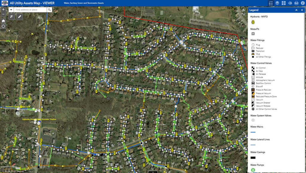
We built the Department of Public Works a GIS hub site for its water, wastewater, and stormwater infrastructure. Staff get mobile access to high-resolution imagery and as-built plans, plus the ability to edit data right from the field, with everything hosted on our servers for security and stability.

How it Works

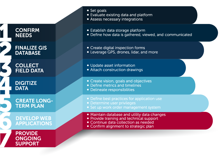
LJB’s GIS analysts guide you through the process, from initial assessment to a system your whole organization can rely on. Check out the graphic or video below to learn more about the steps we take to improve your asset management capabilities.

Contact Us

Lucas Hershberger
GIS Analyst
Bodie Island UAV Assistance

Bodie Island UAV Assistance

Working as a consultant to NCDOT, LJB’s Chris Dustin provided consulting…
Rombach Avenue Improvements

Rombach Avenue Improvements

This project implemented critical safety countermeasures and repaved a 2.19-mile section…

Village GIS Interface Development

Village GIS Interface Development

The Village of Yellow Springs needed an updated GIS solution to…