


Kelly Haws, GISP
GIS Project Manager

100 Fore Street
For this urban redevelopment project, we provided civil design to repurpose…

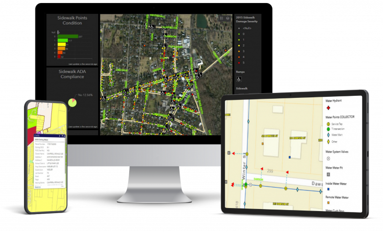
Village GIS Interface Development
The Village of Yellow Springs needed an updated GIS solution to…
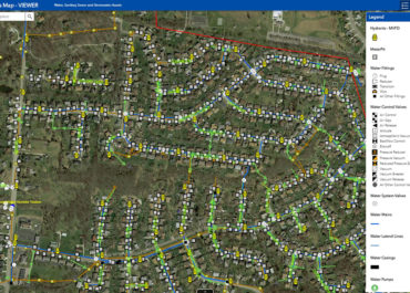
Water Asset Management - Web GIS Implementation
The City of Miamisburg’s Department of Public Works needed a modern…