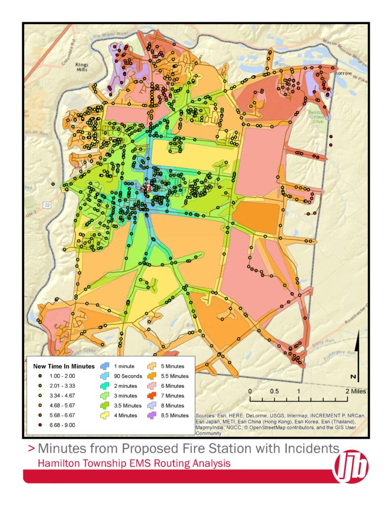
When Hamilton Township was investigating a new fire station location, LJB provided GIS mapping and route analysis to evaluate emergency call response times from existing facility locations, as well as the new proposed location. LJB used the route data to spatially locate address points to analyze the projected emergency response time for the new consolidated facility location. LJB staff applied Esri’s ArcGIS Network Analyst extension to create the route analysis and develop projected response times for each call in the data provided by the township. LJB delivered both a map and a database of response times to assist the township in deciding on a consolidated facility location, as well as potential route improvements to improve response time.

Benchwood Station Transportation Improvements
LJB helped shape the future of the Benchwood Station District, Butler…

Olentangy Augmentation Relief Sewer (OARS) Construction Management
Role: Construction Management, Technical Support Client: City of Columbus Construction Cost: $375…

Alaskan Way Viaduct Replacement Program
Role: Cost and Risk Verification Check and Expert Review Panel Member Client:…